


A winter storm watch remains in effect for Central Massachusetts, but the National Weather Service is now expecting less accumulating snow for the area on Sunday and Monday.
The winter storm watch is in effect from 6 a.m. Sunday to 7 p.m. Monday for all of Worcester County.
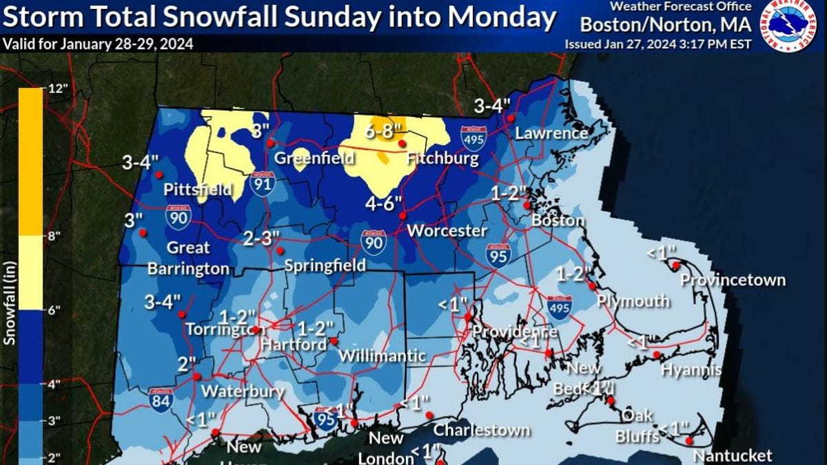
The forecast now calls for a mix of rain and snow throughout Central Massachusetts, with up to 8 inches possible in the higher elevations of northern Worcester County. Earlier forecasts had called for up to a foot of snow in those areas.
The city of Worcester is expected to see 4 to 6 inches of snow, with lesser amounts to the south.
The high will be in the mid 30s on Sunday, and temperatures are expected to drop below freezing overnight. Winds could gust to 35 mph.
The mix of heavy, wet snow and an icy glaze could make for a difficult Monday morning commute, and power failures are possible, the weather service says.
The latest storm will add to what has already been an extraordinary wet month for the Worcester area.
Through the end of Thursday, the city of Worcester had seen 6.59 inches of total precipitation (a combination of snow and rain, melted), which is almost 4 inches above normal, the National Weather Service said.
Beginning Tuesday, the forecast calls for a period of dry weather and seasonable temperatures to extend through the end of the week.
This article was originally published by a www.telegram.com . Read the Original article here. .


